
Datoteka:1771 Bonne Map of France - Geographicus - FranceGov-bonne-1771.jpg

Veličina ovog prikaza: 800 × 580 piksela. Ostale razlučivosti: 320 × 232 piksela | 640 × 464 piksela | 1.024 × 742 piksela | 1.280 × 927 piksela | 2.560 × 1.855 piksela | 3.500 × 2.536 piksela.
Vidi sliku u punoj veličini (3.500 × 2.536 piksela, veličina datoteke: 2,45 MB, MIME tip: image/jpeg)
| Ova je datoteka sa Zajedničkog poslužitelja i mogu je rabiti drugi projekti. Opis s njezine stranice s opisom datoteke prikazan je ispod. |
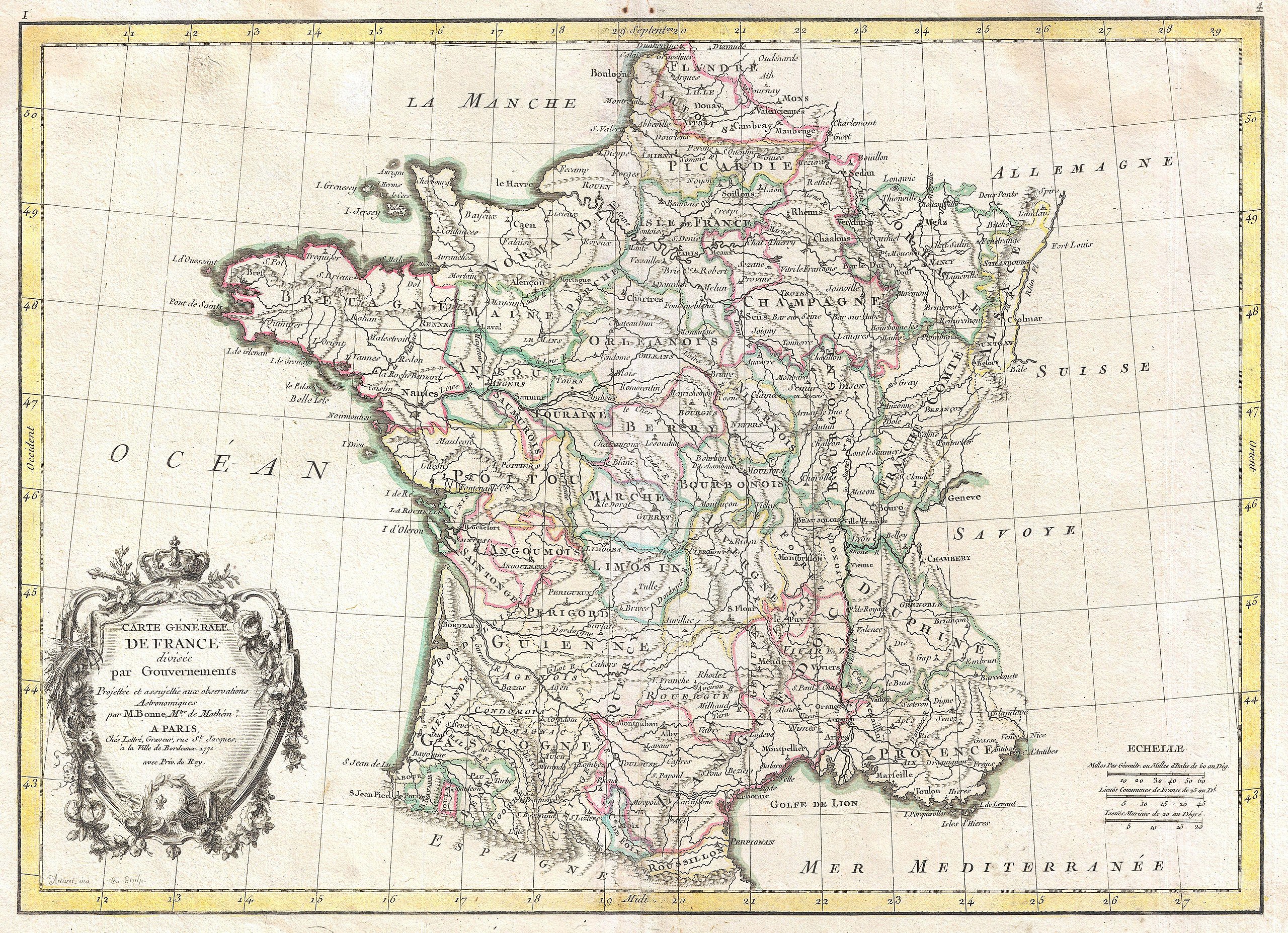
| Rigobert Bonne: Carte Generale de France divisee par Gouvernements.
( |
|||||||||||||||||||||||
|---|---|---|---|---|---|---|---|---|---|---|---|---|---|---|---|---|---|---|---|---|---|---|---|
| Umjetnik/stvaratelj |
|
||||||||||||||||||||||
| Naziv |
Carte Generale de France divisee par Gouvernements. |
||||||||||||||||||||||
| Opis |
English: A beautiful example of Rigobert Bonne's decorative map of France. Covers the entirety of France from Spain to Germany and from the British Channel to the Mediterranean. Divided into provinces with color coding according to region. Offers excellent detail throughout showing mountains, rivers, forests, national boundaries, regional boundaries, forts, and cities. A large decorative title cartouche appears in the lower left quadrant. Drawn by Rigobert Bonne in 1771 for issue as plate no. 4 in Jean Lattre's 1776 edition of the Atlas Moderne . |
||||||||||||||||||||||
| Datum | 1771 (dated) | ||||||||||||||||||||||
| Dimenzije | visina: 12 in (30,4 cm); Širina: 16,5 in (41,9 cm) | ||||||||||||||||||||||
| Inventarni broj |
Geographicus link: FranceGov-bonne-1771 |
||||||||||||||||||||||
| Izvor/fotograf |
Lattre, Jean, Atlas Moderne ou Collection de Cartes sur Toutes les Parties du Globe Terrestre, c. 1775.
|
||||||||||||||||||||||
| Dopuštenje (Naknadna uporaba ove datoteke) |
|
||||||||||||||||||||||
| Ostale inačice | |||||||||||||||||||||||

Povijest datoteke
Kliknite na datum/vrijeme kako biste vidjeli datoteku kakva je tada bila.
| Datum/Vrijeme | Minijatura | Dimenzije | Suradnik | Komentar | |
|---|---|---|---|---|---|
| sadašnja | 19:47, 23. ožujka 2011. | | 3.500 × 2.536 (2,45 MB) | BotMultichillT | {{subst:User:Multichill/Geographicus |link=http://www.geographicus.com/P/AntiqueMap/FranceGov-bonne-1771 |product_name=1771 Bonne Map of France |map_title=Carte Generale de France divisee par Gouvernements. |description=A beautiful example of Rigobert Bon |
Uporaba datoteke
Na ovu sliku vode poveznice sa sljedećih stranica:
Globalna uporaba datoteke
Sljedeći wikiji rabe ovu datoteku:
- Uporaba na sh.wikipedia.org