
Datoteka:Balkans in 1350 according to Gustav Droysen from 19th century.jpg

Vidi sliku u punoj veličini (1.367 × 1.268 piksela, veličina datoteke: 546 KB, MIME tip: image/jpeg)
| Ova je datoteka sa Zajedničkog poslužitelja i mogu je rabiti drugi projekti. Opis s njezine stranice s opisom datoteke prikazan je ispod. |
Sažetak
| Opis |
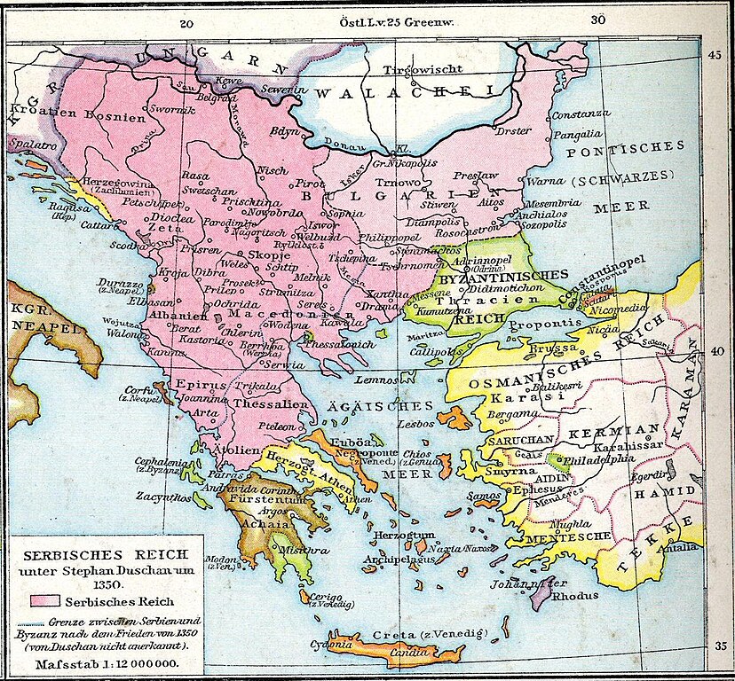
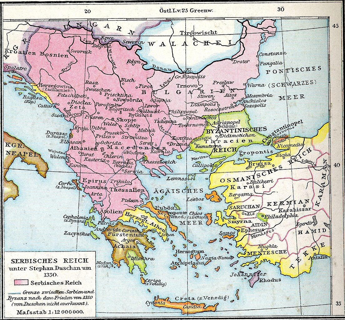
English: Map from late XIX century, representing a view about boundaries of Serbian empire during Stefan Dušan, about 1350. (Modern historiography has a stance that borders of Serbian empire were somewhat different. For the view of modern historiography, please see this map.)
Српски / srpski: Mapa iz druge polovine 19. veka, koja pokazuje gledište o granicama Srpskog carstva u doba Stefana Dušana, oko 1350. godine (Moderna istoriografija zastupa gledište da su granice Srpskog carstva bile nešto drugačije. Za prikaz gledišta moderne istoriografije, pogledati ovu mapu.)
Deutsch: Serbisches Reich |
| Datum | |
| Izvor | Allgemeiner historischer Handatlas |
| Autor | Gustav Droysen |
Licencija
|
Ovo je djelo u javnom vlasništvu u zemlji podrijetla i u drugim zemljama s rokom trajanja autorskih prava za života autora plus 70 godina ili manje.
| |
| Ova datoteka je identificirana kao slobodna od poznatih ograničenja po zakonu o autorskim pravima, uključujući sva povezana i srodna prava. | |
Izvorna evidencija postavljanja
Prebačeno s de.wikipedia na Zajednički poslužitelj Prebacio suradnik Septembermorgen rabeći CommonsHelper.
- 2007-10-17 15:50 Interrex 577×522× (299646 bytes) {{Information |Beschreibung = Allgemeiner historischer Handatlas |Quelle = |Urheber = Gustav Droysen |Datum = 1886 |Genehmigung = |Andere Versionen = |Anmerkungen =
- 2007-10-17 15:44 Interrex 577×522× (41312 bytes) {{Information |Beschreibung = Allgemeiner historischer Handatlas |Quelle = |Urheber = Gustav Droysen |Datum = 1886 |Genehmigung = |Andere Versionen = |Anmerkungen = }}
Povijest datoteke
Kliknite na datum/vrijeme kako biste vidjeli datoteku kakva je tada bila.
| Datum/Vrijeme | Minijatura | Dimenzije | Suradnik | Komentar | |
|---|---|---|---|---|---|
| sadašnja | 23:04, 23. rujna 2015. | | 1.367 × 1.268 (546 KB) | BosnaSRB RS | Карта са српског царства са већом резолуцијом. |
| 13:30, 10. srpnja 2010. |  | 577 × 522 (293 KB) | File Upload Bot (Magnus Manske) | {{BotMoveToCommons|de.wikipedia|year={{subst:CURRENTYEAR}}|month={{subst:CURRENTMONTHNAME}}|day={{subst:CURRENTDAY}}}} {{Information |Description={{de|Serbisches Reich}} |Source=Transferred from [http://de.wikipedia.org de.wikipedia]; transferred to Comm |
Uporaba datoteke
Nijedna stranica ne rabi ovu datoteku.
Globalna uporaba datoteke
Sljedeći wikiji rabe ovu datoteku:
- Uporaba na ar.wikipedia.org
- Uporaba na bg.wikipedia.org
- Uporaba na bs.wikipedia.org
- Uporaba na de.wikipedia.org
- Uporaba na en.wikipedia.org
- Uporaba na et.wikipedia.org
- Uporaba na sh.wikipedia.org
- Uporaba na sr.wikipedia.org