
Datoteka:Montenegro motorways.JPG
Veličina ovog prikaza: 446 × 599 piksela. Ostale razlučivosti: 178 × 240 piksela | 357 × 480 piksela | 571 × 768 piksela | 762 × 1.024 piksela | 1.453 × 1.953 piksela.
Vidi sliku u punoj veličini (1.453 × 1.953 piksela, veličina datoteke: 458 KB, MIME tip: image/jpeg)
| Ova je datoteka sa Zajedničkog poslužitelja i mogu je rabiti drugi projekti. Opis s njezine stranice s opisom datoteke prikazan je ispod. |

|
This transport map image could be re-created using vector graphics as an SVG file. This has several advantages; see Commons:Media for cleanup for more information. If an SVG form of this image is available, please upload it and afterwards replace this template with
{{vector version available|new image name}}.
It is recommended to name the SVG file “Montenegro motorways.svg”—then the template Vector version available (or Vva) does not need the new image name parameter. |


Sažetak
| Opis |
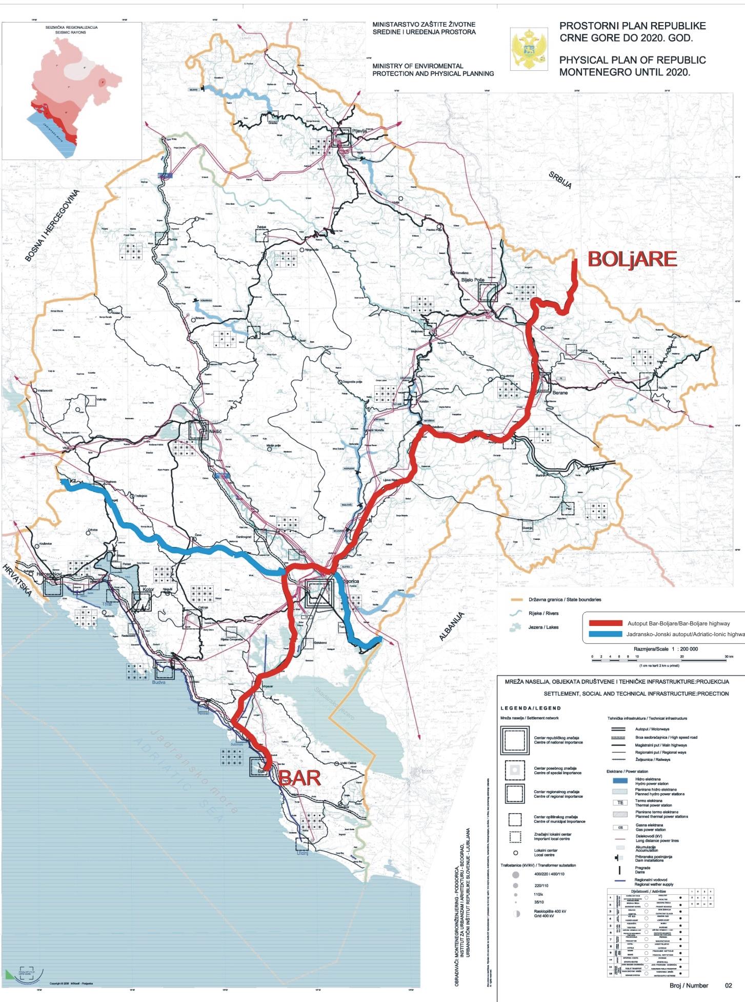
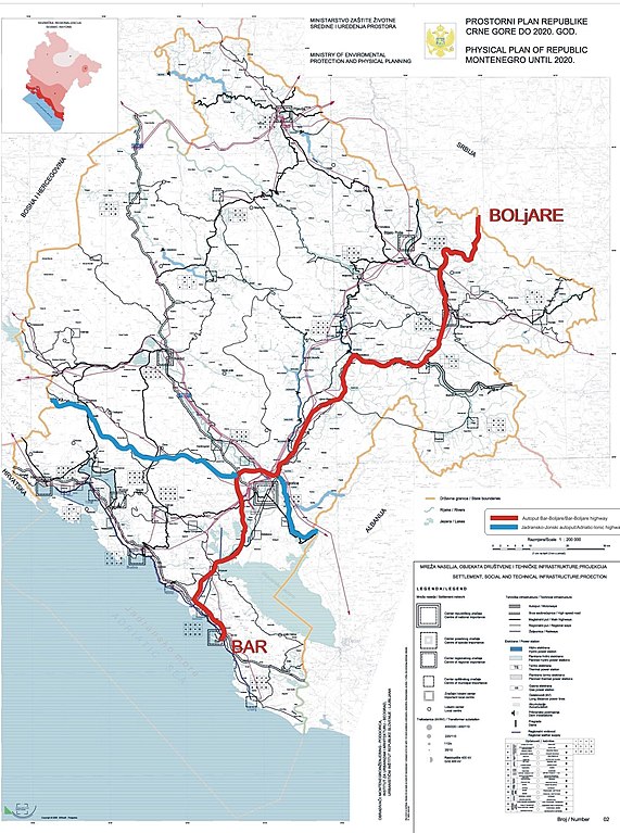
English: Excerpt from Spatial Plan of Montenegro for 2020.
Српски / srpski: Izvod iz Prostornog Plana Crne Gore do 2020 godine. |
| Datum | |
| Izvor | Government of Montenegro |
| Autor | Government of Montenegro |
Licencija
Ja, nositelj autorskog prava za ovo djelo, ovime ga objavljujem pod sljedećom licencijom:
| Ova datoteka je dostupna pod Creative Commons CC0 univerzalnim odricanjem u javno vlasništvo. | |
| Osoba koja je sudjelovala u radu na ovom dokumentu posvetila je rad javnom vlasništvu odricanjem od svih njenih prava na taj rad širom svijeta po zakonom o autorskim pravima i sve povezana zakonska prava koja bi imao/imala, u mjeri dopuštenoj zakonom. Možete kopirati, mijenjati, distribuirati i prilagođavati rad, čak i u komercijalne svrhe, bez traženja dopuštenja.
|
Povijest datoteke
Kliknite na datum/vrijeme kako biste vidjeli datoteku kakva je tada bila.
| Datum/Vrijeme | Minijatura | Dimenzije | Suradnik | Komentar | |
|---|---|---|---|---|---|
| sadašnja | 15:37, 22. listopada 2010. | | 1.453 × 1.953 (458 KB) | Nije bitno... | {{Information |Description={{en|1=Excerpt from Spatial Plan of Montenegro for 2020. }} {{sr|1=Izvod iz Prostornog Plana Crne Gore do 2020 godine.}} |Source=Government of Montenegro |Author=Government of Montenegro |Date=2006-12-06 |Permission= |other_vers |
Uporaba datoteke
Na ovu sliku vode poveznice sa sljedećih stranica:
Globalna uporaba datoteke
Sljedeći wikiji rabe ovu datoteku:
- Uporaba na cs.wikipedia.org
- Uporaba na de.wikipedia.org
- Uporaba na en.wikipedia.org
- Uporaba na it.wikipedia.org
- Uporaba na lv.wikipedia.org
- Uporaba na mk.wikipedia.org
- Uporaba na nl.wikipedia.org
- Uporaba na pl.wikipedia.org
- Uporaba na ro.wikipedia.org
- Uporaba na ru.wikipedia.org
- Uporaba na sq.wikipedia.org
- Uporaba na sr.wikipedia.org
- Uporaba na te.wikipedia.org
- Uporaba na uk.wikipedia.org
- Uporaba na www.wikidata.org
- Uporaba na zh.wikipedia.org