
Datoteka:Map of the Arctic region showing the Northeast Passage, the Northern Sea Route and Northwest Passage, and bathymetry.png

Veličina ovog prikaza: 632 × 600 piksela. Ostale razlučivosti: 253 × 240 piksela | 506 × 480 piksela | 1.003 × 952 piksela.
Vidi sliku u punoj veličini (1.003 × 952 piksela, veličina datoteke: 758 KB, MIME tip: image/png)
| Ova je datoteka sa Zajedničkog poslužitelja i mogu je rabiti drugi projekti. Opis s njezine stranice s opisom datoteke prikazan je ispod. |
Sažetak
| Opis |
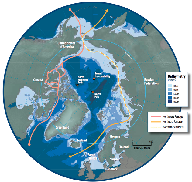
English: Map of the Arctic region showing shipping routes Northeast Passage, Northern Sea Route, and Northwest Passage, and bathymetry |
| Datum | |
| Izvor | Arctic Council - Arctic marine shipping assessment - http://www.arctic.noaa.gov/detect/documents/AMSA_2009_Report_2nd_print.pdf |
| Autor | Susie Harder |
Licencija
This file is in the public domain because the work was created/published by the Arctic Council, an international organization
|
Povijest datoteke
Kliknite na datum/vrijeme kako biste vidjeli datoteku kakva je tada bila.
| Datum/Vrijeme | Minijatura | Dimenzije | Suradnik | Komentar | |
|---|---|---|---|---|---|
| sadašnja | 18:46, 19. listopada 2014. | | 1.003 × 952 (758 KB) | Al83tito | User created page with UploadWizard |
Uporaba datoteke
Na ovu sliku vode poveznice sa sljedećih stranica:
Globalna uporaba datoteke
Sljedeći wikiji rabe ovu datoteku:
- Uporaba na bn.wikipedia.org
- Uporaba na de.wikipedia.org
- Uporaba na en.wikipedia.org
- Uporaba na es.wikipedia.org
- Uporaba na fa.wikipedia.org
- Uporaba na fr.wikipedia.org
- Uporaba na he.wikipedia.org
- Uporaba na hu.wikipedia.org
- Uporaba na id.wikipedia.org
- Uporaba na it.wikipedia.org
- Uporaba na ja.wikipedia.org
- Uporaba na ko.wikipedia.org
- Uporaba na nl.wikipedia.org
- Uporaba na pl.wikipedia.org
- Uporaba na pt.wikipedia.org
- Uporaba na ru.wikipedia.org
- Uporaba na sd.wikipedia.org
- Uporaba na te.wikipedia.org
- Uporaba na th.wikipedia.org
- Uporaba na tr.wikipedia.org