
Datoteka:1850 Mitchell Map of Austria, Hungary and Transylvania - Geographicus - Austria-mitchell-1850.jpg

Veličina ovog prikaza: 755 × 600 piksela. Ostale razlučivosti: 302 × 240 piksela | 604 × 480 piksela | 967 × 768 piksela | 1.280 × 1.017 piksela | 2.560 × 2.033 piksela | 3.000 × 2.383 piksela.
Vidi sliku u punoj veličini (3.000 × 2.383 piksela, veličina datoteke: 2,31 MB, MIME tip: image/jpeg)
| Ova je datoteka sa Zajedničkog poslužitelja i mogu je rabiti drugi projekti. Opis s njezine stranice s opisom datoteke prikazan je ispod. |
| Samuel Augustus Mitchell: Austrian Empire.
( |
||||||||||||||||||||
|---|---|---|---|---|---|---|---|---|---|---|---|---|---|---|---|---|---|---|---|---|
| Umjetnik/stvaratelj |
|
|||||||||||||||||||
| Naziv |
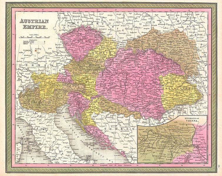
Austrian Empire. |
|||||||||||||||||||
| Opis |
English: An extremely attractive example of S. A. Mitchell Sr.’s 1850 map of the Austrian Empire. Includes much of today's Austria, Hungary, Romania, Albania, Serbia and Croatia. Depicts the entire country color coded according to individual states. Lower right quadrant features an inset map of the Environs of Vienna. Surrounded by the green border common to Mitchell maps from the 1850s. Prepared by S. A. Mitchell for issued as plate no. 56 in the 1850 edition of his New Universal Atlas . |
|||||||||||||||||||
| Datum | 1850 (undated) | |||||||||||||||||||
| Dimenzije | visina: 12 in (30,4 cm); Širina: 15 in (38,1 cm) | |||||||||||||||||||
| Inventarni broj |
Geographicus link: Austria-mitchell-1850 |
|||||||||||||||||||
| Izvor/fotograf |
Mitchell Sr., S. A.,A New Universal Atlas Containing Maps of the various Empires, Kingdoms, States and Republics Of The World. (1850 issue)
|
|||||||||||||||||||
| Dopuštenje (Naknadna uporaba ove datoteke) |
|
|||||||||||||||||||
Povijest datoteke
Kliknite na datum/vrijeme kako biste vidjeli datoteku kakva je tada bila.
| Datum/Vrijeme | Minijatura | Dimenzije | Suradnik | Komentar | |
|---|---|---|---|---|---|
| sadašnja | 03:09, 23. ožujka 2011. | | 3.000 × 2.383 (2,31 MB) | BotMultichillT | {{subst:User:Multichill/Geographicus |link=http://www.geographicus.com/P/AntiqueMap/Austria-mitchell-1850 |product_name=1850 Mitchell Map of Austria, Hungary and Transylvania |map_title=Austrian Empire. |description=An extremely attractive example of S. A |
Uporaba datoteke
Na ovu sliku vode poveznice sa sljedećih stranica:
Globalna uporaba datoteke
Sljedeći wikiji rabe ovu datoteku:
- Uporaba na en.wikipedia.org
- Uporaba na es.wikipedia.org
- Uporaba na sh.wikipedia.org
- Uporaba na uk.wikipedia.org