
Datoteka:Brittain 410.jpg
Vidi sliku u punoj veličini (1.111 × 1.497 piksela, veličina datoteke: 369 KB, MIME tip: image/jpeg)
| Ova je datoteka sa Zajedničkog poslužitelja i mogu je rabiti drugi projekti. Opis s njezine stranice s opisom datoteke prikazan je ispod. |
Sažetak
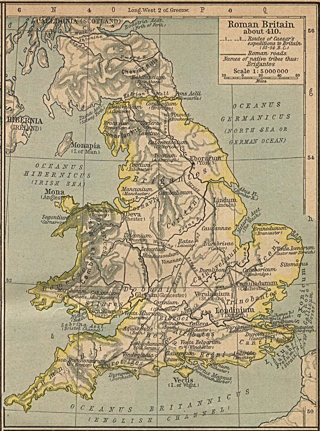
Map of the isle Great Britain in the year 410. Image comes from the Historical Maps of Europe at University of Texas at Austin The work is from From The Historical Atlas by William R. Shepherd, 1926.
Map is released into the public Domain.
Licencija
|
Ovo je djelo u javnom vlasništvu u zemlji podrijetla i u drugim zemljama s rokom trajanja autorskih prava za života autora plus 70 godina ili manje.
| |
| Ova datoteka je identificirana kao slobodna od poznatih ograničenja po zakonu o autorskim pravima, uključujući sva povezana i srodna prava. | |
Povijest datoteke
Kliknite na datum/vrijeme kako biste vidjeli datoteku kakva je tada bila.
| Datum/Vrijeme | Minijatura | Dimenzije | Suradnik | Komentar | |
|---|---|---|---|---|---|
| sadašnja | 17:24, 3. prosinca 2005. | | 1.111 × 1.497 (369 KB) | Migdejong | Map of the isle Great Brittain in the year 410. Image comes from the University of Texas at Austin: http://geography.about.com/gi/dynamic/offsite.htm?site=http://www.lib.utexas.edu/maps/historical/history%5Feurope.html Map is released into the publi |
Uporaba datoteke
Na ovu sliku vode poveznice sa sljedećih stranica:
Globalna uporaba datoteke
Sljedeći wikiji rabe ovu datoteku:
- Uporaba na ar.wikipedia.org
- Uporaba na arz.wikipedia.org
- Uporaba na azb.wikipedia.org
- Uporaba na bn.wikipedia.org
- Uporaba na br.wikipedia.org
- Uporaba na ca.wikipedia.org
- Uporaba na cy.wikipedia.org
- Uporaba na el.wikipedia.org
- Uporaba na en.wikipedia.org
- Uporaba na es.wikipedia.org
- Uporaba na et.wikipedia.org
- Uporaba na fr.wikipedia.org
- Uporaba na hu.wikipedia.org
- Uporaba na hy.wikipedia.org
- Uporaba na is.wikipedia.org
- Uporaba na it.wikipedia.org
- Uporaba na lt.wikipedia.org
- Uporaba na pl.wikipedia.org
- Uporaba na ru.wikipedia.org
- Uporaba na sh.wikipedia.org
- Uporaba na sl.wikipedia.org
- Uporaba na sr.wikipedia.org
- Uporaba na zh.wikipedia.org