
Datoteka:Gilbert Islands, central Pacific Ocean (MODIS 2016-06-04).jpg

Veličina ovog prikaza: 461 × 599 piksela. Ostale razlučivosti: 184 × 240 piksela | 369 × 480 piksela | 591 × 768 piksela | 788 × 1.024 piksela | 2.000 × 2.600 piksela.
Vidi sliku u punoj veličini (2.000 × 2.600 piksela, veličina datoteke: 974 KB, MIME tip: image/jpeg)
| Ova je datoteka sa Zajedničkog poslužitelja i mogu je rabiti drugi projekti. Opis s njezine stranice s opisom datoteke prikazan je ispod. |
.jpg)
Sažetak
| Opis |
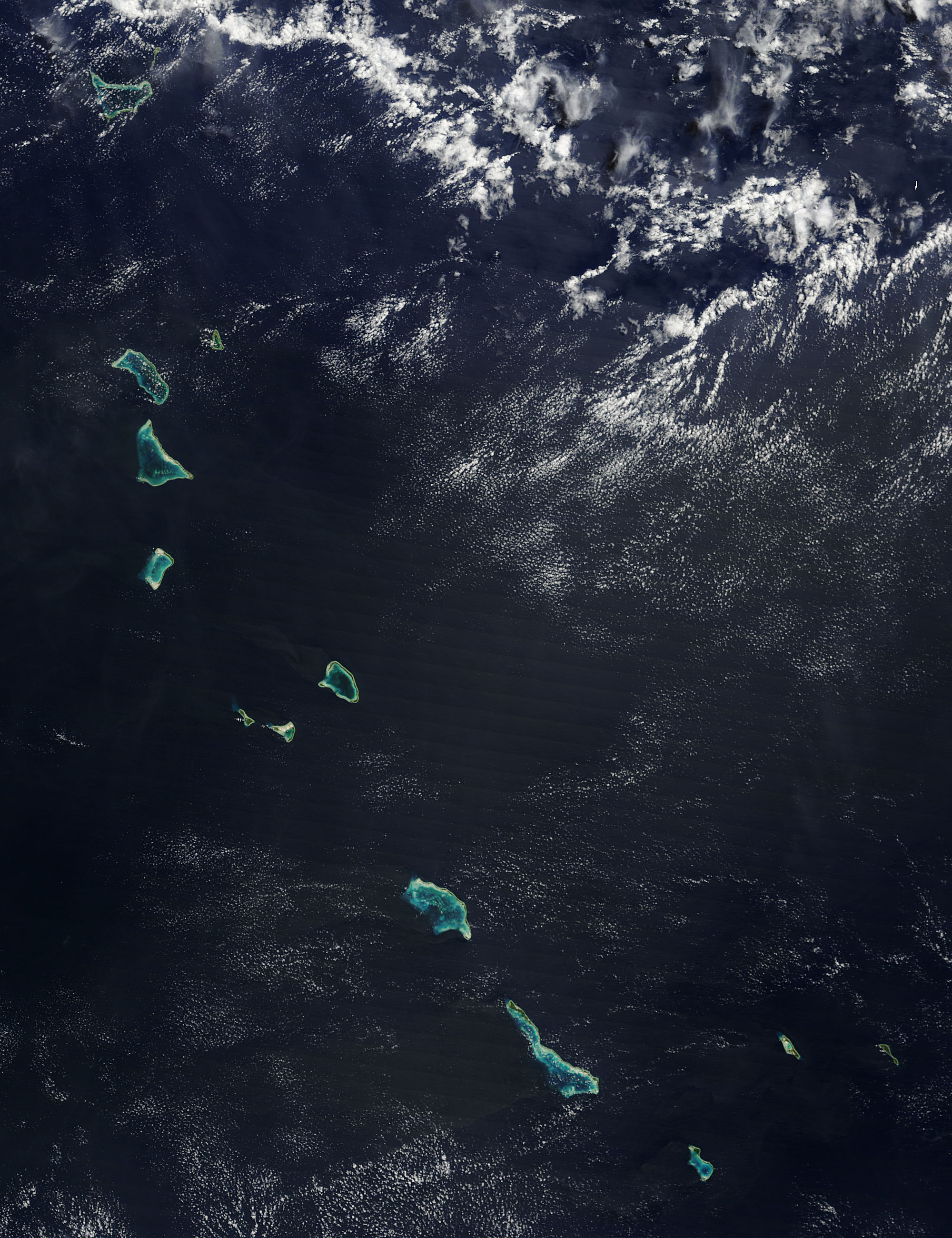
English: White sands and jewel-toned waters marked the presence of a chain of islands and atolls in the central Pacific Ocean as NASA's Terra satellite looked down upon the scene. The Moderate Resolution Imaging Spectroradiometer (MODIS) aboard that satellite captured this true-color image on May 30, 2016.
The Gilbert Islands are part of the nation of Republic of Kiribati, an island nation comprised of 32 low-lying coral atolls and raised coral islands. Each atoll is formed from the top of undersea volcanoes, and each rises only a few feet above sea level. The islands lie about 930 miles north of Fiji and straddle the equator. |
||
| Datum | Fotografirano: 30. svibnja 2016. | ||
| Izvor |
Gilbert Islands, central Pacific Ocean (direct link)
|
||
| Autor | Jeff Schmaltz, MODIS Land Rapid Response Team, NASA GSFC |
| This media is a product of the Terra mission Credit and attribution belongs to the mission team, if not already specified in the "author" row |
Licencija
| This file is in the public domain in the United States because it was solely created by NASA. NASA copyright policy states that "NASA material is not protected by copyright unless noted". (See Template:PD-USGov, NASA copyright policy page or JPL Image Use Policy.) | ||
 |
Warnings:
|
Povijest datoteke
Kliknite na datum/vrijeme kako biste vidjeli datoteku kakva je tada bila.
| Datum/Vrijeme | Minijatura | Dimenzije | Suradnik | Komentar | |
|---|---|---|---|---|---|
| sadašnja | 21:32, 15. veljače 2024. | | 2.000 × 2.600 (974 KB) | OptimusPrimeBot | #Spacemedia - Upload of http://modis.gsfc.nasa.gov/gallery/images/image06042016_250m.jpg via Commons:Spacemedia |
Uporaba datoteke
Na ovu sliku vode poveznice sa sljedećih stranica:
.jpg)