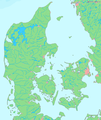
Datoteka:La2-demis-denmark.png

Stranica ne postoji na drugim jezicima.
Izvor: Wikipedija

La2-demis-denmark.png(507 × 600 piksela, veličina datoteke: 230 KB, MIME tip: image/png)


Logo Wikimedijinog spremnika Ova je datoteka sa Zajedničkog poslužitelja i mogu je rabiti drugi projekti. Opis s njezine stranice s opisom datoteke prikazan je ispod.
Opis
English: Map of Denmark.

Bounding box West 7.9°, South 54.3°, East 13.2°, North 57.8°.

Center at 56°03′00″N 10°33′00″E / 56.05000°N 10.55000°E / 56.05000; 10.55000.
Datum
Izvor Demis map server
Autor Demis map server


Public domain
This image is in the public domain because it came from the site https://www.demis.nl/products/web-map-server/examples/ and was released by the copyright holder. Permission is granted to copy, distribute and/or modify this map since it is based on free of copyright images from: www.demis.nl. See also approval email on de.wp and its clarification.

Deutsch | English | македонски | മലയാളം | Nederlands | slovenščina | +/−

Public domain This work has been released into the public domain by its copyright holder, www.demis.nl. This applies worldwide.
U nekim državama to nije pravno moguće; ako je tako:
www.demis.nl daje svima prava da koriste ovo djelo za bilo koju svrhu, bez ikakvih uvjeta, osim ako takvi uvjeti nisu propisani zakonom.


This map image could be re-created using vector graphics as an SVG file. This has several advantages; see Commons:Media for cleanup for more information. If an SVG form of this image is available, please upload it and afterwards replace this template with {{vector version available|new image name}}.


It is recommended to name the SVG file “La2-demis-denmark.svg”—then the template Vector version available (or Vva) does not need the new image name parameter.

Opisi

Dodajte kratko objašnjenje što predstavlja ova datoteka

Predmeti prikazani u ovoj datoteci

motiv

2. rujna 2005

Povijest datoteke

Kliknite na datum/vrijeme kako biste vidjeli datoteku kakva je tada bila.

Datum/VrijemeMinijaturaDimenzijeSuradnikKomentar
sadašnja14:59, 17. veljače 2008.Minijatura za inačicu od 14:59, 17. veljače 2008.507 × 600 (230 KB)Hubertus45{{Information |Description=Map of cities in Denmark |Source=self-made |Date= |Author= Hubertus45 |Permission= |other_versions= }}
00:22, 15. travnja 2007.Minijatura za inačicu od 00:22, 15. travnja 2007.650 × 769 (45 KB)Tene~commonswikiOptimised (0)
15:36, 2. rujna 2005.Minijatura za inačicu od 15:36, 2. rujna 2005.650 × 769 (67 KB)LA2Map of Denmark. Bounding box West 7.9°, South 54.3°, East 13.2°, North 57.8°. {{demis-pd}} category:maps of Denmark

Nijedna stranica ne rabi ovu datoteku.

Globalna uporaba datoteke

Sljedeći wikiji rabe ovu datoteku: